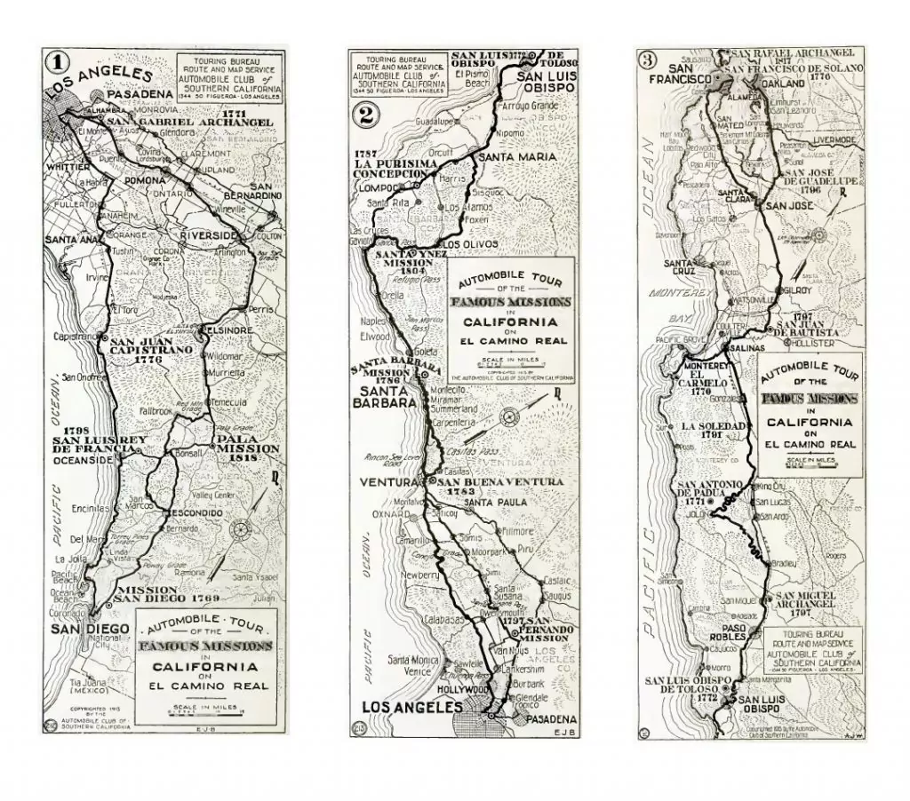
In 1915 the Automobile Club of Southern California published a 36-page pamphlet titled California’s Mission Tour. The subtitle was A motoring guide with maps and sketches compiled by the Automobile Club of Southern California. The first paved roads were still in the future. The handsome maps in the 34-page booklet gave the impression that driving from mission-to-mission would be a lovely holiday. At the time, the Mission Revival period was getting into full swing, and the roads just dirt tracks.
The Automobile Club of Southern California claimed in 1915 that nearly 7000 members were enrolled and they were the largest motoring organization in this country.
The introduction reads as follows:
California’s Golden Age is no more reflected in the past than in the present. Today is linked to yesterday by the “Cathedrals in the Sun”—California’s Missions. Here for the first time, is presented a complete tour of all the Missions located between the two Expositions. In presenting this data to the visiting and the resident motorists, the Automobile Club of Southern California has attempted a simple arrangement of fact. The route, known to historians as El Camino Real (The King’s Highway), has, by popular usage, become known as the “Coast Route.” All of the missions are located here. Time should be no object in wandering along this route of the padres. Each crumbling ruin (and all are not ruins) has its individual story, its history. Inquiry at Club headquarters for up-to-date road information is advised.
A PDF of the pamphlet is here and in the Library of Congress.
Automobile Club Of Southern California. California’s Mission Tour. Los Angeles, Calif.: Automobile Club of Southern California, 1915.
Web. https://lccn.loc.gov/15011018.