On July 16, 1769, the Spanish Franciscan friar Junipero Serra planted a cross and founded the Mission San Diego near the Kumeyaay village of Nipawai. Over the next 54 years, friars would establish 20 more missions and military forts and call the road connecting them El Camino Real (the King’s Highway).
But for thousands of years before the Spanish conquest, California had been crisscrossed in every direction by hundreds of Native pathways and trading routes, many of which would reach far beyond the state’s present borders.
While the California Missions Foundation seeks to nominate El Camino Real as an international cultural corridor and historic site, a growing number of Native Californians prefer to have their traditional pathways and trade routes recognized in a special way.
Examples of such trade routes abound, according to historians, archeologists, and anthropologists. The noted anthropologist Alfred Kroeber chronicled the discovery of a woven burial cloth imported from the Pueblo Indians near Buena Vista Lake in what is today California’s Kern County. He called it one of the few authentic instances of long-distance trade of any manufactured article, either into out of California…
READ FULL ARTICLE
LEARN MORE →
University Of California Archaeological Survey Trade Routes and Economic Exchange Among the Indians of California by James T. Davis. Issued March 31, 1961.
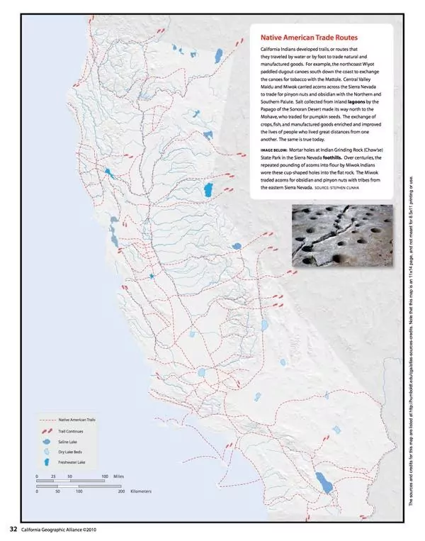
Digital map showing trading routes, missions, and other information: Native America Trading Routes
Tip: select layers and check “trails” and “Missions”