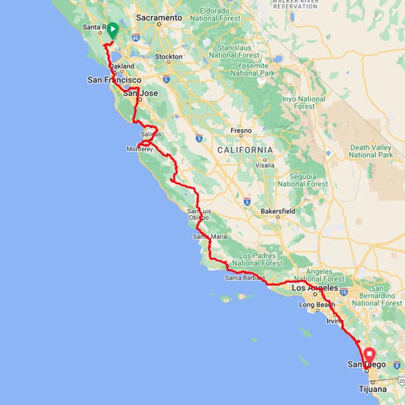
Sonoma to San Diego GPX File
This is the 2022 edition of the primary California Missions Trail (CMT) from Mission Sonoma to Mission San Diego, following the north-to-south route. The download includes a GPX and a KML File. Free with a donation.
How do I use a GPX file?
On desktop
There are several applications that you can use to open GPX files and view routes. The easiest way to open a GPX file and view the map data it contains is by uploading it to the web version of Google Maps. After you open and sign in to Google Maps in your web browser, you can add a GPX file as a new map by:
1. Opening the Google Maps menu (three lines) and selecting
2. Your places → Maps → Create Map (at the bottom of the column).
3. A new Google Maps window opens. In that window, select the Import link/button that appears underneath the Untitled layer.
4. Upload your GPX file. The map data the file contains will appear in Google Maps.
On a Smartphone
There are many great apps that allow the viewing of GPX files. Some to consider are:
→ RunGo – Free on iOS and Android.
→ Gaia – is not free but has a lot of features.
1. Email a GPX file to yourself or upload the GPX file to your Google Drive account.
2. On your phone, open the app you choose and then upload the GPX file into the app.
